:: home
:: books
:: gallery
:: data
:: blog
:: kids
:: shop
:: bio
:: help
:: contact
:: ChrisKridler.com


Words/images COPYRIGHT © 2021 by Chris Kridler. All rights reserved. Do not use Sky Diary photos on other Web sites. Personal use as computer wallpaper is permitted, but do not distribute photos. Write for information about purchasing video, photographs or articles. | Frequently asked questions
|
|
gallery: May 17, 2010
May 17, 2010: I started the day in Andrews, Texas, did a forecast, and decided that southeastern New Mexico would be the best starting point, with the idea of intercepting the best storms that fired on the higher elevations. I hung out in Hobbs, New Mexico, using a McDonald's free wireless connection to look at satellite and radar images. Though storms were firing in Texas, I liked the look of a beast southwest of Roswell and caught up with it in Artesia. Convection was rampant in the area, as was lightning. I ended the day with a great mammatus show south of Roswell.
Share
Click on the thumbnails to see a larger image, or view these photos as a gallery. From the gallery pages, click the "up" arrow to return to this index.
 |
 |
 |
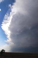
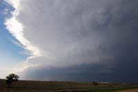
| I thought southeastern New Mexico was a good target, so I drove to Hobbs and hung out there for a while, looking at satellite and radar to see what would fire on the higher elevations. Finally I committed to this storm, which I caught up with in Artesia. |
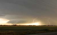
Here's a look at the eastern part of the storm. Lots of convection! |
The base of the storm was reminiscent of the Starship Enterprise. |
 |
 |
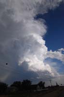 |
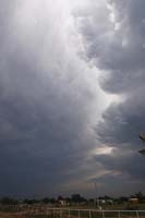
| Convection got chunky in the storm - again, looking at the eastern part. |
The cell appeared to become more elongated. At this time, storms were exploding all over southeastern New Mexico. |
The storm just to the south showed aggressive convection. |
 |
 |
 |
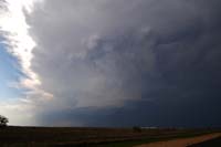
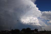
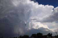
| The southern storm kept growing ... |
... and growing! |
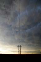
A storm to the west of Artesia produced at least golfball-size hail, but it weakened. Here's a shot of it near sunset. |
 |
 |
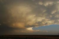 |
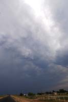
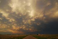
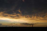
| I had booked a room in the Texas Panhandle for the night, so I headed north of Artesia toward Roswell, and the mammatus show began. |
The light was subtle at first. |
Ah, orange. |
 |
 |
 |
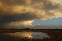
| The southern cell still churned, as reflected in a puddle. |
A look to the east. |
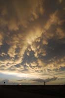
The clouds assumed a silky appearance. |
 |
 |
 |
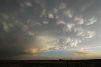
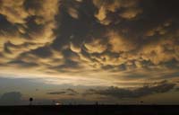
| Criss-crossing mammatus. |
The last dab of light... |
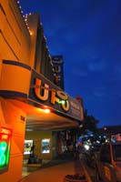
Parting shot: Lingering mammatus look blue behind the UFO Museum in Roswell. |
2010 reports and photos
go to the main gallery page | go to storm chasers
go to reports from 2010, 2009, 2008, 2007, 2006, 2005, 2004, 2003, 2002, 2001, 2000, 1999, 1998, 1997
|
