:: home
:: books
:: gallery
:: data
:: blog
:: kids
:: shop
:: bio
:: help
:: contact
:: ChrisKridler.com


Words/images COPYRIGHT © 2021 by Chris Kridler. All rights reserved. Do not use Sky Diary photos on other Web sites. Personal use as computer wallpaper is permitted, but do not distribute photos. Write for information about purchasing video, photographs or articles. | Frequently asked questions
|
|
gallery: May 16, 2010
May 16, 2010: I was on my own today. I drove from Carlsbad, New Mexico, to Odessa, Texas, and got an oil change, expecting that I might have a chance to chase whatever popped up later in that area. But by the time I was done, the biggest severe storms were going up in Oklahoma. That was out of reach, and I liked the boundary and bit of moisture convergence in eastern New Mexico, near Clovis. I started heading in that direction when just a few compact storms started to pop. Despite less than ideal conditions, a couple went severe, slowly moved southeast, and made for a fun and photogenic chase.
Share
Click on the thumbnails to see a larger image, or view these photos as a gallery. From the gallery pages, click the "up" arrow to return to this index.
 |
 |
 |
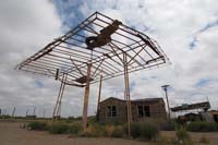
| I started the day in Carlsbad, New Mexico, and headed south with the idea of getting an oil change in Odessa. Derelict structures sidetracked me along the way. |
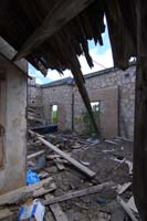
I'm not sure if this was a business or a house, but it was full of trash, sadly. |
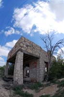
One can imagine this building's better days. |
 |
 |
 |
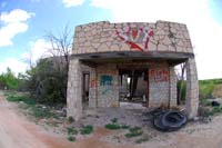
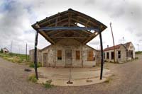
| Orla, N.M., has multiple intriguing derelict structures. |
Another old gas station in Orla gave me a chance to contemplate the sky and the possibilities for storms. |
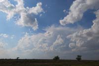
I got my oil change in Odessa, Texas, and then looked at weather data. With storms ongoing in Oklahoma, I turned my sights on myriad boundaries in the Texas panhandle and headed toward a dot of moisture convergence on a boundary in eastern New Mexico, where storms began to pop up. |
 |
 |
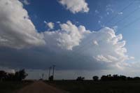 |
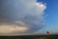
| By the time I got to the area in play, west of Denver City, Texas, just inside of New Mexico, two little storms were working on the meager moisture available. This is the northern one. |
The northern storm was more powerful at first and showed hints of structure as it moved southeast. |
The southern storm also gained strength. |
 |
 |
 |
| I liked the northern storm better, at first. |
Somehow, storms look more dramatic behind abandoned houses. |
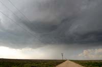
I buzzed back east into Texas and looked at both storms. On radar, they were comparable in strength, so for ease of navigation - and in case the southern storm took over - I decided to get south of them and focus on that one. |
 |
 |
 |
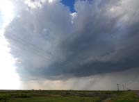
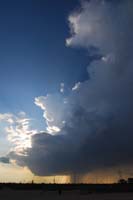
| I was glad I did. The light was beautiful as the storm strengthened. |
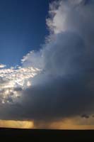
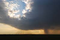
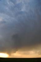
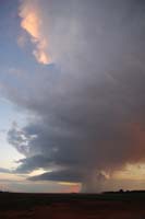
As the storm grew, so did the hail, prompting a severe storm warning. |
The hail shaft had a deceptive, tornado-like appearance. |
 |
 |
 |
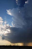
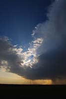
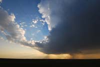
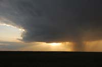
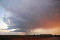
| A similar photo, but you can see the hail core extending south. |
Wow ... great light. |
Here's a look at the swirling clouds in the top of the storm. There were several signs of weak rotation. |
 |
 |
 |
| Beams of light extended from top and bottom. |
Here's a closer look at the swirls in the storm. |
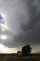
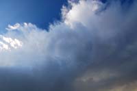
The precipitation never really wrapped around this LP supercell. |
 |
 |
 |
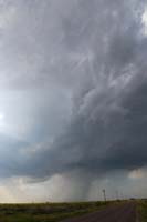
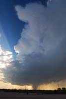
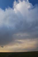
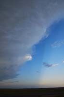
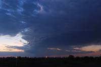
| The base began to show signs of rotation. |
A slightly wider view. |
A look east reveals a few mammatus in the storm. |
 |
 |
 |
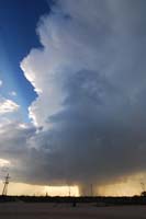
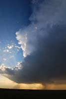
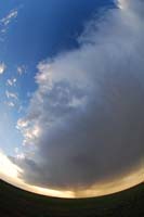
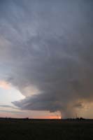
| I used a fisheye lens to show off the structure. |
Mammatus and color. |
The sun began to set behind the storm. |
 |
 |
 |
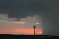
| A look east reveals more lovely rays. |
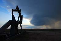
An oil pump continues its work as the storm approaches. |
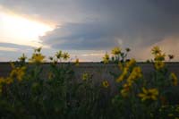
Wildflowers and the storm south of Denver City, Texas. |
 |
 |
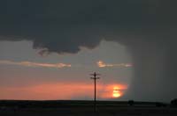 |
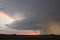
| The storm began to form a wall cloud at sunset. |
The heavy precipitation core, the sunset and a nascent wall cloud. |
The wall cloud exhibited only hints of rotation. |
 |
 |
 |
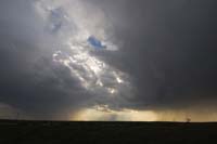
| The storm appeared to be shrinking, but the precip was still intense. |
The wall cloud evolves. |
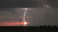
A video grab of the intense lightning at the heart of the storm, as seen from south of Denver City, Texas. |
 |
 |
 |
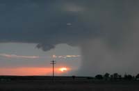
| The light was divine on the shrinking storm. |
What a vanishing act! |
Severe warnings were canceled as the storm collapsed at dark. |
2010 reports and photos
go to the main gallery page | go to storm chasers
go to reports from 2010, 2009, 2008, 2007, 2006, 2005, 2004, 2003, 2002, 2001, 2000, 1999, 1998, 1997
|
