May 18, 2013: I chased today with old friends, including Dave Lewison, Scott McPartland, Dayna Vettese and Brad Rousseau, Greg Stephens, and Mark Robinson and his crewmate Jaclyn Whittal. We started the day in North Platte, Nebraska, and eyed favorable wind profiles and a dryline to act as a trigger for the storms. They started early, and thus started a long and exciting chase.
Share
Storm chase from Ness City to between Larned and Rozel, Kansas, culminating in two tornadoes.
Click on the thumbnails to see a larger image.
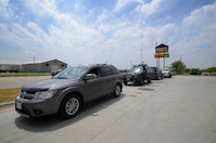
Our group stopped in Oakley, Kansas, to assess the best target for May 18, 2013.
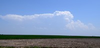
We headed toward where the dryline was pushing out into western Kansas and were rewarded with bubbling convection.
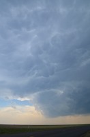
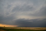
Here's a shot of the growing storm near Ness City, as seen out the windshield.
The storm bubbled and grew and tried to organize near Ness City, Kansas.
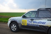
Mark Robinson drives The Weather Network truck … this was just before said truck was used to jump-start my car.
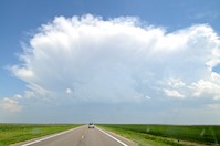
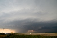
The storm exhibited nice mammatus clouds and iffy organization.
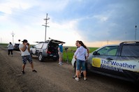
We all shot photos and video, waiting for the storm to mature.
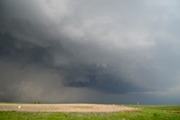
A couple of storms seemed to converge.
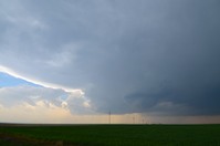
We headed north of town to watch it evolve.
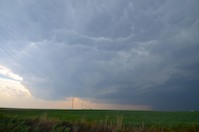
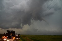
A succession of wall-cloud-type features formed.
The storm just didn't seem to want to gel, though Scott and Dave sampled baseball hail in the core.
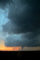
We decided to drop south to a rapidly organizing storm west of Larned and heard tornado reports on the way, to our chagrin. But we got there just in time for this one.
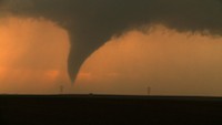
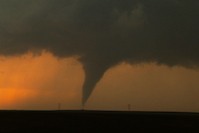
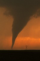
The cone lasted several minutes.
The base/wall cloud and tornado.
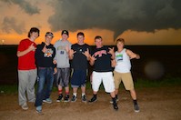
A group of local kids wanted their photo taken in front of a storm. Why can't I get a photo of me like this? Hee hee.
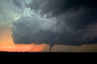
The backlit tornado kept grinding away.
This is a video grab. Great light. But then...
A tornado was touching down right behind us, to the east, as we were filming the storm to the west!
Here it is, lit by lightning - there was a dust swirl on the ground for a minute or two.
Another shot shows the dust swirl. Too close for comfort.
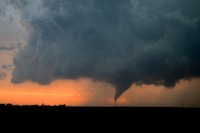
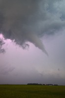
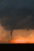
Back to the main show - what a beautiful tornado.
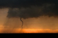
A long rope-out stage began.
The funnel was snaky and sinuous at this point.
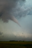
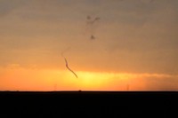
Just when we thought it was over, a tiny wisp of funnel persisted.
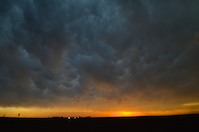
Mammatus clouds are lit by the setting sun.
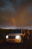
A rainbow and lightning serve as a backdrop for The Weather Network truck as Mark jumps in.
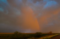
The rainbow was surrounded by intense lightning, which provided a great show as the lined-out storms moved east. Driving in the rain, I couldn't get photos of it.