
:: books
:: gallery
:: data
:: blog
:: kids
:: shop
:: bio
:: help
:: contact
:: ChrisKridler.com


|
Words/images COPYRIGHT © 2021 by Chris Kridler. All rights reserved. Do not use Sky Diary photos on other Web sites. Personal use as computer wallpaper is permitted, but do not distribute photos. Write for information about purchasing video, photographs or articles. | Frequently asked questions |
gallery: May 11, 2011
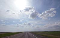
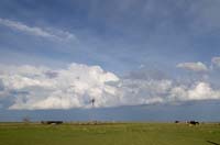
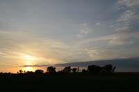
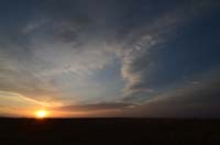
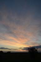
May 11, 2011: It's hardly worth summarizing today, except to note that the days with the highest expectations - a couple of days ago, this seemed as if it would be the best Plains chase day of the first half of May - often don't meet those expectations. Were there storms? Yes. But despite some tornadoes early in the day in an area deemed not worth chasing, overall, this was not a big tornado day, despite a strong upper trough and other good dynamics. In the morning, clouds and rain covered much of the area, but the grunge moved out, allowing for heating and therefore energy for storms. But the dewpoints stayed depressed, and the clustered storms in northeast Colorado/northwest Kansas didn't quite get their act together to produce tornadoes. I made a conscious choice to go after an isolated cell in my target area instead, around Dodge City and north, but it fizzled, and I ended up seeing little worth noting.
Share
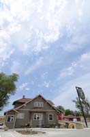
Click on the thumbnails to see a larger image, or view these photos as a gallery. From the gallery pages, click the "up" arrow to return to this index.
go to the main gallery page | go to storm chasers
go to reports from 2011, 2010, 2009, 2008, 2007, 2006, 2005, 2004, 2003, 2002, 2001, 2000, 1999, 1998, 1997