
:: books
:: gallery
:: data
:: blog
:: kids
:: shop
:: bio
:: help
:: contact
:: ChrisKridler.com


|
Words/images COPYRIGHT © 2021 by Chris Kridler. All rights reserved. Do not use Sky Diary photos on other Web sites. Personal use as computer wallpaper is permitted, but do not distribute photos. Write for information about purchasing video, photographs or articles. | Frequently asked questions |
storm gallery: May 7, 2009
Click on the thumbnails to see a larger image, or view these photos as a gallery. From the gallery pages, click the "up" arrow to return to this index.
 |
 |
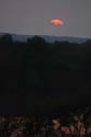 |
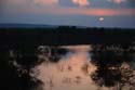
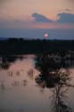
| The sun set over Elk City Reservoir. | Ah, the glowing orb. | Going, going... |
 |
 |
 |
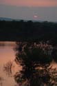
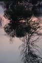
| ... Gone. | The reservoir offered opportunity for reflection. | As the sun set, the full moon rose over the prairie. |
go to the main gallery page | go to storm chasers
go to reports from 2008, 2007, 2006, 2005, 2004, 2003, 2002, 2001, 2000, 1999, 1998, 1997