:: home
:: books
:: gallery
:: data
:: blog
:: kids
:: shop
:: bio
:: help
:: contact
:: ChrisKridler.com


Words/images COPYRIGHT © 2021 by Chris Kridler. All rights reserved. Do not use Sky Diary photos on other Web sites. Personal use as computer wallpaper is permitted, but do not distribute photos. Write for information about purchasing video, photographs or articles. | Frequently asked questions
|
|
storm gallery: May 5, 2009
May 5, 2009: My initial target was somewhere between Abilene and Seymour, Texas, where the dryline push and warm front were likely to intersect and where upper-level winds would enhance storms. I would refine that forecast on the road. I left Amarillo in the mist and cold and, after a data stop in Childress, I dropped south.
Share
Click on the thumbnails to see a larger image, or view these photos as a gallery. From the gallery pages, click the "up" arrow to return to this index.
 |
 |
 |
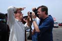
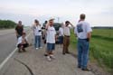
| I found the Cloud 9 Tours group in Aspermont, so I goofed around with them for a while as I kept an eye on the clearing satellite picture. |
Some took advantage of a Dairy Queen break. |
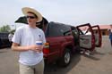
John Guyton drives one of the tour's vehicles. |
 |
 |
 |
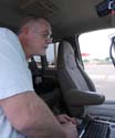
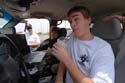
| Charles Edwards tries to get his live streaming video working. |
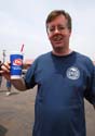
Mike Theiss takes a sip. |
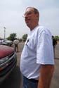
The camera catches George Kourounis. |
 |
 |
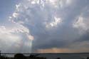 |
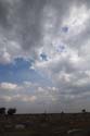
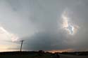
| I left the Cloud 9 folks because I wanted to get a little southeast, where the forecast suggested storms might fire, and near the field of cumulus clouds near the warm front. This is east of Anson. At first, they weren't much to look at. |
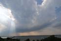
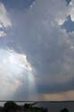
Soon, the clouds starting percolating in the afternoon heat and began to form a nascent storm, here seen from a picnic area that overlooks Hubbard Creek Reservoir, west of Breckenridge. |
The towering cumulus evolves. |
 |
 |
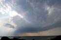 |
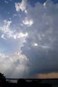
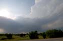
| The budding storm began to develop an inflow feature (right). |
The cell gets organized. |
The cell's inflow became stronger as it moved east. |
 |
 |
 |
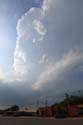
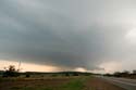
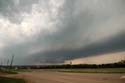
| From Breckenridge, the tower looked solid. At this time, I began to see massive chaser caravans. |
Here's a view of the base, as seen from Breckenridge. |
The storm became elongated as it moved east of town. |
 |
 |
 |
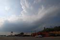
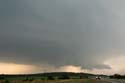
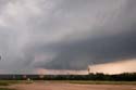
| Though the storm became disorganized, the towers at its southwest end began building and dominating. This is just east of Breckenridge. |
I ran into the Cloud 9 group again. We were among dozens of chasers (at least) who were following the storm. |
The storm gained strength; note two inflow tails (at left). |
 |
 |
 |
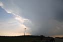
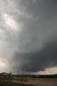
| I repositioned and got a nice view of a wall cloud forming. It began rotating as small hail began falling around me. |
Here's a closeup of the area of rotation. It didn't quite do it, and I headed east to get out of the hail, as did Cloud 9 and many others. |
Driving through the hail was stressful, but I stayed ahead of the bigger stones, despite a lot of banging on the car. The reward: this beautiful rotating wall cloud crossing Interstate 20 at Route 16. |
 |
 |
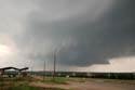 |
| Here's a closeup of the storm's base. |
The rotation made it seem likely a tornado was imminent. |
I was with Cloud 9 again, and we decided to hop east to try to get ahead of it so we could see it if it put down a tornado. What we weren't counting on was the hail. |
 |
 |
|
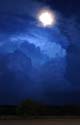
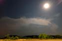
| The National Weather Service cited a preliminary storm report of grapefruit-size hail - 5 inches across - with this storm, just north of our location, and it was moving southeast. I bailed and took shelter, but I missed the worst of the core. A baseball-size stone cracked John Guyton's windshield. Meanwhile, I got a few shots of the retreating storm and the rising moon. |
Here's another shot of the weakening storm as it moved southeast, with the moon shining above. |
2009 reports and photos
go to the main gallery page | go to storm chasers
go to reports from 2008, 2007, 2006, 2005, 2004, 2003, 2002, 2001, 2000, 1999, 1998, 1997
|
