 |
 |
 |
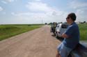
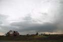
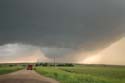
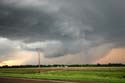
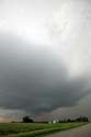
| On June 7, west of Beatrice, Nebraska, Dave Lewison checks out the distant anvils from a line of storms forming to the west. A line was undesirable, but we hoped one cell would break out and dominate. |
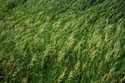
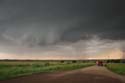
West of Beatrice, Nebraska, wheat blows hard in the southerly wind. |
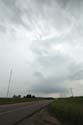
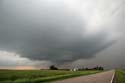
As we approached the line, a small, weak storm cell had features that indicated rotation. |
 |
 |
 |
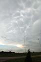
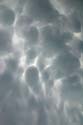
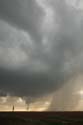
| The storms also had lovely mammatus clouds. |
Here's an enhanced shot of the mammatus clouds in the anvil. |
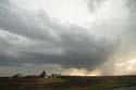
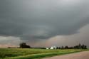
Near the town of Jewell, Kansas, a rotating storm cell looms behind a tornado-damaged house. |
 |
 |
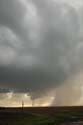 |
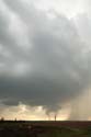
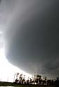
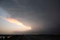
| The cell developed an interesting lowering. |
This lowering northwest of Jewell looked very much like a tornado. I am inclined to call it a funnel. It was pretty thready, and heavy on scud, but it was in the right place and appeared to be rotating weakly. |
The funnel-like feature lingered for a few minutes before retreating. |
 |
 |
 |
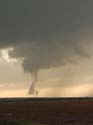
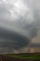
| Here's a closeup of the feature. Though suggestive, it does not appear to be a tornado. |
Here's another look. The small cell definitely showed signs of rotation; just look at its curved shape. |
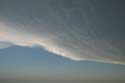
Next we turned to what had been the dominant cell in the line and now had become large and in charge. This is a quick shot I took on Route 24 near Cawker City, Kansas, while driving of the storm's anvil and its "furrows" of mammatus clouds. |
 |
 |
 |
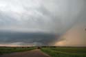
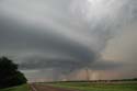
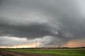
| We had to get close to the cell - north of Osborne, where Route 24 meets 281 - to see its incredible structure and power. A smooth, rotating base had a clear wall cloud/area of rotation, at right. |
The storm was rotating gloriously. |
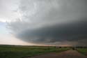
Here's another look at the storm's fantastic mothership structure. Meanwhile, a funnel had formed under that large wall cloud in the rain at right. |
 |
 |
 |
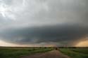
| Another shot of the rotating storm. |
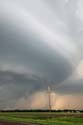
When this huge lowering appeared, I thought a large tornado was in the offing. Then rain began to wrap around it. |
A new mesocyclone began to form on the east side of the storm. |
 |
 |
 |
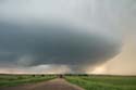
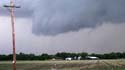
| Look at the gorgeous curvature of the rotating storm's base. |
A lowering descends from the new meso. |
There is clearly a funnel in the lowering. |
 |
 |
 |
| Here's another view of the storm and funnel. |
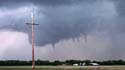
The wall cloud had multiple vortices. |
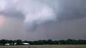
Here's a closeup of the tiny tornado that finally touched down. |
 |
 |
 |
| The multi-funnel wall cloud managed to connect with the ground with at least this one, slim tornado. |
For a moment, it appeared the wall cloud might produce another tornado with this swirl. It didn't. |
The two mesos persisted but did not apparently put down another tornado. |
 |
 |
 |
| The weakening meso remained beautiful as it passed over this house. |
And one more look ... |
Another view... |
 |
|
|
| A new storm, with a classic hook echo on radar indicating rotation, developed behind the big one. |


