:: home
:: books
:: gallery
:: data
:: blog
:: kids
:: shop
:: bio
:: help
:: contact
:: ChrisKridler.com


Words/images COPYRIGHT © 2021 by Chris Kridler. All rights reserved. Do not use Sky Diary photos on other Web sites. Personal use as computer wallpaper is permitted, but do not distribute photos. Write for information about purchasing video, photographs or articles. | Frequently asked questions
|
|
storm gallery: May 1, 2008
May 1, 2008: It was gray and cloudy when I woke up in Muskogee, Oklahoma, and I knew I wanted to get closer to the dryline and probably north, in an area from Independence, Kansas, to Bartesville, Oklahoma. I was concerned that winds wouldn't back much, as the upper-level support for storms would come into the area late, but the projected CAPE (convective available potential energy) was huge, and I was hoping for the storms to happen before dark.
Click on the thumbnails to see a larger image, or view these photos as a gallery. From the gallery pages, click the "up" arrow to return to this index.
 |
 |
 |
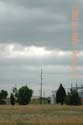
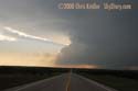
| Gray skies in Muskogee, Oklahoma, pushed me to go west and north for sunlight and better heating, near the dryline. |
I made my way to Bartlesville, Oklahoma, north of Tulsa. It has water towers that say hot-warm-cold. Perhaps if you combine them correctly, they can produce a tornado. |
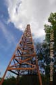
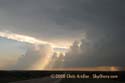
Bartlesville's historic Nellie Johnstone No. 1 oil well, the first commercial oil well in Oklahoma, points to developing cumulus clouds. |
 |
 |
 |
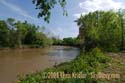
| Bartlesville's historic Nellie Johnstone No. 1 oil well sits next to this muddy waterway. |
When I looked at a satellite image on my iPhone, I noticed slighly beefier dots of cumulus north, so I went that way. North of Bartlesville, once one of these towers broke the cap, the storm grew fast. |
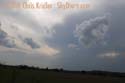
The developing storm in southeast Kansas had a beautiful anvil (shot through the buggy windshield). It quickly became severe. |
 |
 |
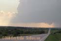 |
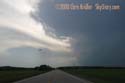
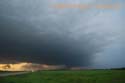
| West of Independence, Kansas, the storm develops. |
West of Independence, Kansas, the embedded cell had hard convection and showed rotation at the mid-levels. |
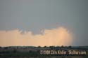
The storm had a succession of wall clouds and scuddy lowerings. |
 |
 |
 |
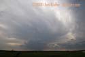
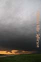
| More scud and wall-cloudy features. |
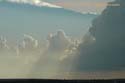
West of Independence, Kansas, a serious flanking line developed and produced more storms that fed into the line. |
West of Independence, Kansas, the storm developed nicely. |
 |
 |
 |
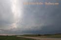
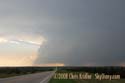
| West of Independence, Kansas, the storm was a beautiful sight. |
The flanking line was impressive. |
The storm still had a tornado warning as darkness fell. |
 |
 |
|
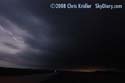
| Even as darkness fell, scuddy lowerings suggested the storm and its line were up to something. |
I followed the line north of Independence, Kansas, and the embedded, rotating storm until dark, then gave up. Despite tornado warnings and a report of a brief touchdown, I didn't see one. |
2008 reports and photos
go to the main gallery page | go to storm chasers
go to reports from 2007, 2006, 2005, 2004, 2003, 2002, 2001, 2000, 1999, 1998, 1997
|
