
:: books
:: gallery
:: data
:: blog
:: kids
:: shop
:: bio
:: help
:: contact
:: ChrisKridler.com


|
Words/images COPYRIGHT © 2021 by Chris Kridler. All rights reserved. Do not use Sky Diary photos on other Web sites. Personal use as computer wallpaper is permitted, but do not distribute photos. Write for information about purchasing video, photographs or articles. | Frequently asked questions |
storm gallery: May 9-11, 2001
To see a larger version of a photo, just click on its thumbnail image below. Then, to get back to this page, hit the "back" button on your browser.
|
|---|
| On May 9, Dave Lewison and I headed from Nebraska up into Iowa and then southwest Minnesota, where the wind profile was more favorable for rotation among the storms beginning to fire on the front. We saw in the distance the storm that eventually produced tornadoes, and liked the looks of it, but there was no way we could catch it. We settled for this storm. Images from video. |
 |
 |
|---|---|
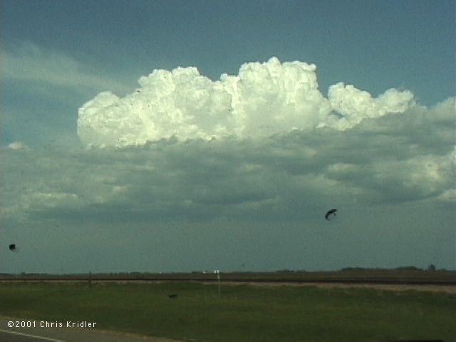
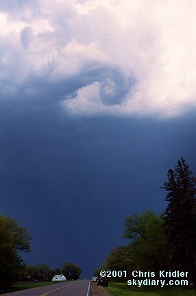
| The storm in southwest Minnesota had a crisp anvil and nice convection but was high-based for some time. Image from slide. | We met up with Ontario chasers George Kourounis and Mark Robinson before we saw this beautiful rotation in the clouds. It lasted for a few minutes, but the high-based storm didn't want to put down a tornado. Image from slide. |
 |
 |
|---|---|
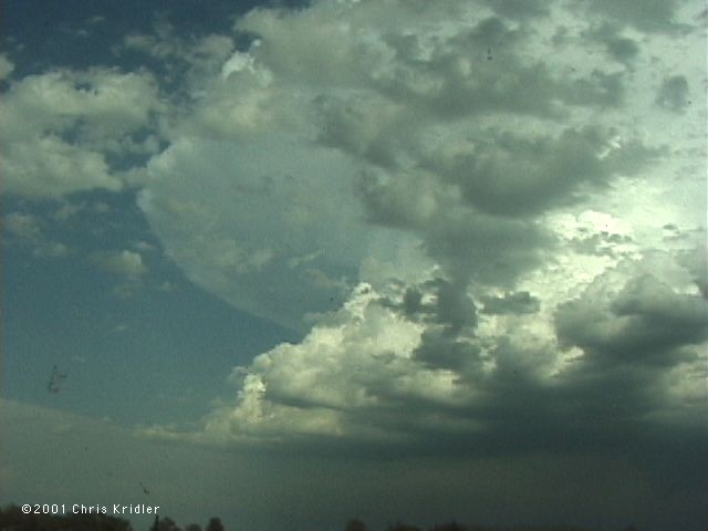
| Mark's car, the "Enraged Mosquito," crouches under the roiling storm. Image from slide. | The storm tried again to get its act together as inflow rushed into the finally-lowered base, but it failed. Image from video. |
 |
 |
|---|---|
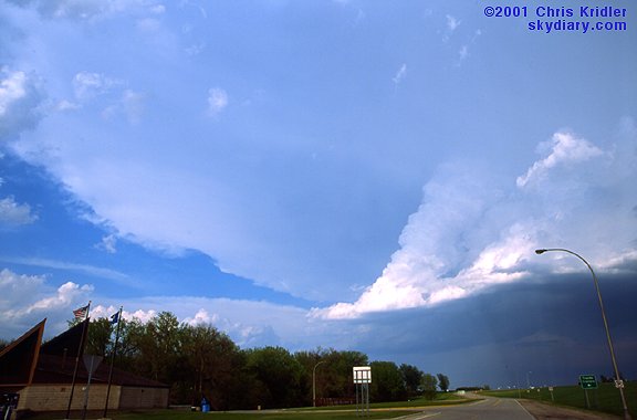
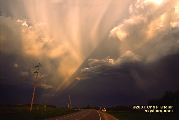
| As the storm above moved east, it was overtaken by this beautiful storm moving northeast, with its gorgeous curtains of hail and rain illuminated by the setting sun. Images from slides. | |
 |
|---|
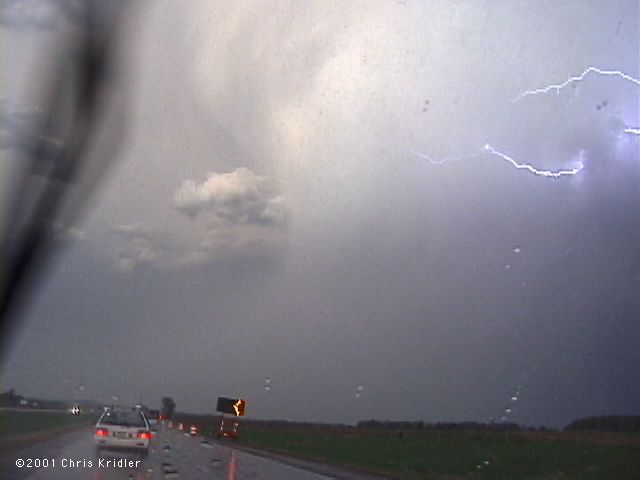
| The northeast-moving storm had a distinctive hail shaft. Here lightning sparks out of the storm as we drive toward it. Image from video. |
 |
 |
|---|---|
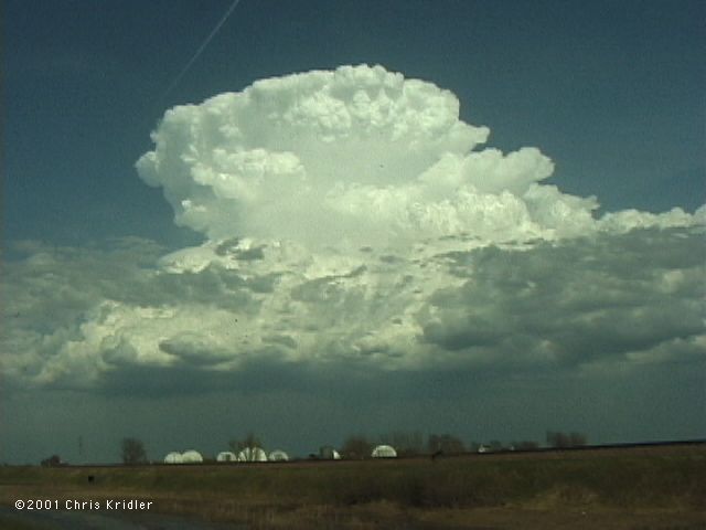
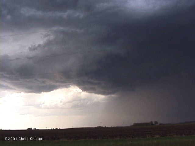
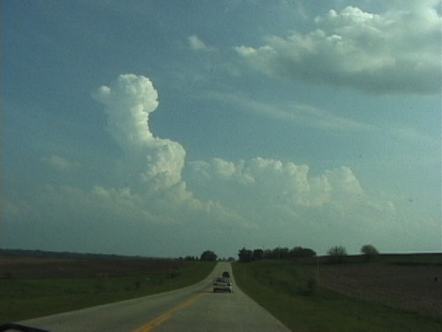
| On May 10, Dave, George, Mark and I targeted southwest Iowa. Later in the day, we liked the way things looked around the Iowa-Missouri border, where the cap broke with the rise of this turkey tower. Image from video. | The storm in hilly northwest Missouri seemed to be shaping up, and though we heard the tornado warnings for way the heck northeast in Iowa, we knew we couldn't get to that storm. This one seemed like our only hope for good action, especially since it was isolated and in front of the line forming along the front. Image from video. |
 |
 |
|---|---|
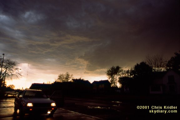
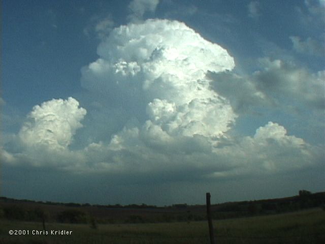
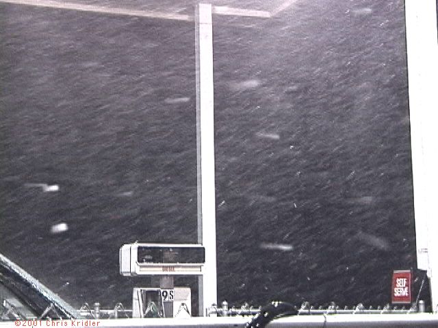
| The May 10 storm exploded, a true convection bomb. This was the view out the front window of the car as we got closer to it. The problem: The base of the storm never lowered and never fulfilled the promise of the tremendous convective power above it. Image from video. | We ended up getting a taste of the pyrotechnics in the line of severe storms when we stopped north of Maryville, Missouri. Under this overhang at a gas station, we experienced extremely high winds and small hail. Image from video. |
 |
|---|
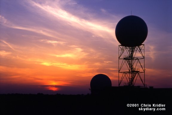
| Around May 11, this gorgeous sunset backlit the radar domes at the National Severe Storms Laboratory in Norman, Oklahoma. Image from slide. |
Links to 2001 chase reports:
- February 14-March 31: Fog, a few storms and blue-sky distractions in drought-stricken Florida
- May 6-8: Roiling severe storms in Oklahoma and a mothership in Kansas
- May 9-11: Pretty storms in Iowa, Minnesota and Missouri
- May 16-19: Lightning and downpours during a Kansas chase and an outflow boundary from heck in Texas
- May 20: A too-close encounter with a tornadic supercell in Oklahoma
- May 23-27: Dust devils, Texas storms and a dust-bowl-style gust front in Kansas
- May 28: Beautiful storms in Colorado and a tornado at dusk
- May 29: A monster, rotating, layer-cake supercell in the Texas panhandle
- May 30: A gorgeous storm from New Mexico that produced hail from hell
- May 31-June 1: A look at Texas tornado damage and pretty rotating storms in Kansas
- June 3-24: Severe storms and fantastic lightning in Florida
- July 3-August 4: Shelf clouds sweep over the water in east-central Florida
- August 10-11: The Florida Keys offer a skinny waterspout and shimmering sunsets
- August 17-23: Florida again proves itself king of the shelf clouds, lightning and sunsets
- August 31-September 24: A layered gust front, lightning and the remnants of Tropical Storm Gabrielle
go to the main gallery page | go to storm chasers
go to reports from 2001, 2000, 1999, 1998, 1997